While driving with friends to watch a basketball game in Washington Park in 1979, Caroline O’Boyle (Communication ’82) was pulled over by a police officer who told her to “go home immediately” because he thought it was a dangerous area for white people to be in. She said similar situations still happen today, more than 40 years later.
O’Boyle, a Chicago native, said her experiences have helped inform her work as Illinois state director at the Trust for Public Land, a non-profit that protects and restores green spaces.
“When you travel from an under-resourced community to a heavily resourced community, you can’t help but notice the disparities. But if you never travel out of those communities, you won’t understand it,” she said.
O’Boyle is one of many people interviewed about the long-term effects of segregation in the book “Don’t Go” by Tonika Lewis Johnson and Maria Krysan. One such harmful effect is the disparity in access to nature between the North Side of Chicago and the South and West Sides of Chicago.
In 2017, Johnson founded the Folded Map Project, which visually connects Chicago residents living at corresponding North Side and South Side addresses through photography and video interviews.
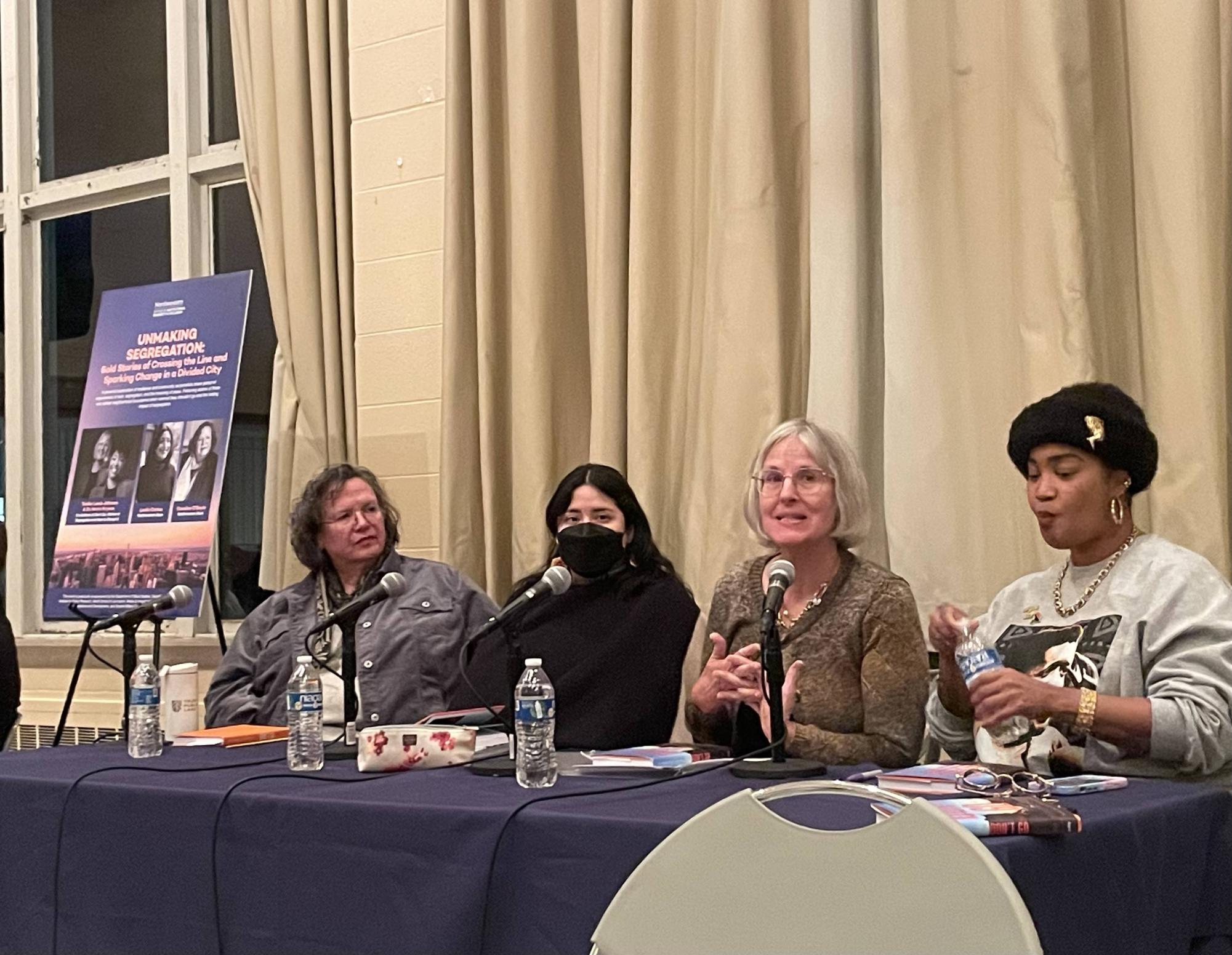
“It just became clear to me that the ‘don’t go’ narrative was the avenue to really extend that conversation,” Johnson said at the “Unmaking Segregation” speaker event in Parkes Hall on Jan. 15. “When we talk about neighborhoods and places, we all know you’re talking about people.”
Katie Fleming is the senior forestry program manager at Openlands, a non-profit committed to conservation in Illinois. She said residents across Chicago benefit from access to nature, making it imperative to increase the amount of trees in the city.
“For us humans in an urban environment, there’s a lot of studies out there that prove anyone who lives closer to green space is typically healthier, mentally and physically,” she said. “Kids who live closer to parks get more exercise, reduced obesity rates, but also reduced anxiety and depression, and ADHD symptoms.”
Fleming added that trees benefit the city economically and environmentally, as they prevent soil erosion, lower long-term infrastructure costs, take up stormwater in communities prone to flooding and reduce asthma risks in high-pollutant neighborhoods.These effects are especially evident in industrial corridors — many of which are on the West Side.
Leslie Cortez (School of Professional Studies ’21), a youth organizer at the Little Village Environmental Justice Organization, shared their story in “Don’t Go” as a person hailing from a predominantly Hispanic neighborhood in Chicago.
“It resonated deeply with many of us on the West and South Side. We watched our Chicago landscape transform, and we return home and we see this (lack of) investment in our parks, our lack of green spaces as we travel from school, from work, et cetera,” Cortez said at the panel.
One way to measure a neighborhood’s access to nature is the urban tree canopy (UTC), or the area of land covered by tree branches, leaves and stems. According to the Chicago Region Trees Initiative’s 2020 tree census, the most recent data available, the average canopy coverage in Chicago is 19%.
While some neighborhoods have almost 30% UTC coverage, many areas in the South Side and West Side have less than 15% coverage.
Another relevant statistic from the tree census is the amount of tree canopy in comparison to plantable space, or the land cover types in a neighborhood that can be converted into canopy. Calculating the ratio of tree canopy to plantable space shows vegetation and bare soil are going underutilized in the South Side, and even more so on the West Side.
The only wards in Chicago with more canopy than plantable space are on the North Side.
Fleming is also a member of the Urban Tree Canopy Team at the Chicago Wilderness Alliance. She said because trees are part of “green infrastructure” — and one of the only resources that increase in value, providing more benefits over time — the composition of trees in a neighborhood must be considered in addition to total canopy coverage.
“Our engagement has always been focused on communities that have low canopy (coverage), but also an aging canopy,” she said. “There’s a lot of communities that only have large and mature trees that are going to age out at some point. So having diversity, not just in species, but diversity in the ages of the trees planted in a community is incredibly important.”
According to a 2021 study of 37 U.S. cities, including Chicago, there is a statistically significant relationship between a neighborhood’s percentage of UTC coverage and historical Home Owners’ Loan Corporation (HOLC) grade, which were given between 1935 and 1940.
HOLC maps outlined neighborhoods in green for “best” and red for “hazardous,” largely along lines of race and class, leading to the term “redlining.” Formerly green neighborhoods have the highest average percentage of UTC coverage at 41.1%, while formerly red neighborhoods have an average of 20.9% coverage.
There are ongoing efforts to mitigate the long-term impacts of redlining, such as the Our Roots Chicago project. The initiative, which began in 2022, aims to plant 75,000 trees in five years with an equitable approach.
O’Boyle said the Trust for Public Land is currently consulting the Chicago Park District in a process called the Park Equity Accelerator, which uses data to inform decision-making about where new parks and new amenities for existing parks are needed.
“While the (Chicago Park District) itself makes an effort to share its research or spread its resources equitably around the city, because of the institutions that exist in these communities it follows that communities in wealthier areas of the city, those parks have more resources,” O’Boyle said. “They have local businesspeople who support programming. They have people who have the capacity to serve on Park Advisory Councils and volunteer their time.”
Fleming said an additional factor dictating her work is funding from the Justice40 Initiative. Justice40 established a federal government-wide goal that 40% of the benefits of certain federal investments flow to disadvantaged communities that are marginalized, underserved and overburdened by pollution.
O’Boyle said addressing the disparity in access to green spaces in the city is still a work in progress.
“Joining their local Park Advisory Council is one way to go, attending Chicago Park District board meetings is another way to go, organizing a local cleanup of your park or a fundraising campaign for your park is another way to go,” she said. “But it’s a systemic challenge and so it’s going to require a systemic solution.”
Email: [email protected]
Related Stories:
— Land Use Commission questions need for Envision Evanston rezoning overhaul